著名医師による解説が無料で読めます
すると翻訳の精度が向上します
研究の前提:小型空中ドローン(マイクロ有効航空機[UAVS])を使用した低エレベーション調査は、小規模から中サイズの地域の植生のマッピングなど、植物生態学のさまざまな用途に使用できます。調査を実施するための方法と手順の概要を説明し、これらのアプリケーションの一部を説明します。 方法:航空画像は、関心のある領域に沿ってトランセクトに沿って小さなドローンを飛ばすことによって取得されました。画像を使用して、複合画像(オルソモサイック)とデジタル表面モデル(DSM)を作成しました。植生分類は手動で実施され、自動化されたルーチンを使用しました。個々の種のカバレッジは、航空画像から推定されました。 結果:オルソモサックとDSMから地域全体の植生地図を作成し、1つの種の密度をマッピングしました。マニュアルと自動化された生息地の分類の比較により、マッピング方法が正確であることが確認されました。バックグラウンドマトリックスとは対照的な種は、そのカバレッジを適切に推定することができました。 議論:調査の例は、小さな空中ドローンが、敏感な生息地への影響を最小限に抑える植生と個々の種の分布に関する大量の情報を収集できることを示しています。低発生航空調査は、植物生態学における幅広い用途の可能性があります。
研究の前提:小型空中ドローン(マイクロ有効航空機[UAVS])を使用した低エレベーション調査は、小規模から中サイズの地域の植生のマッピングなど、植物生態学のさまざまな用途に使用できます。調査を実施するための方法と手順の概要を説明し、これらのアプリケーションの一部を説明します。 方法:航空画像は、関心のある領域に沿ってトランセクトに沿って小さなドローンを飛ばすことによって取得されました。画像を使用して、複合画像(オルソモサイック)とデジタル表面モデル(DSM)を作成しました。植生分類は手動で実施され、自動化されたルーチンを使用しました。個々の種のカバレッジは、航空画像から推定されました。 結果:オルソモサックとDSMから地域全体の植生地図を作成し、1つの種の密度をマッピングしました。マニュアルと自動化された生息地の分類の比較により、マッピング方法が正確であることが確認されました。バックグラウンドマトリックスとは対照的な種は、そのカバレッジを適切に推定することができました。 議論:調査の例は、小さな空中ドローンが、敏感な生息地への影響を最小限に抑える植生と個々の種の分布に関する大量の情報を収集できることを示しています。低発生航空調査は、植物生態学における幅広い用途の可能性があります。
PREMISE OF THE STUDY: Low-elevation surveys with small aerial drones (micro-unmanned aerial vehicles [UAVs]) may be used for a wide variety of applications in plant ecology, including mapping vegetation over small- to medium-sized regions. We provide an overview of methods and procedures for conducting surveys and illustrate some of these applications. METHODS: Aerial images were obtained by flying a small drone along transects over the area of interest. Images were used to create a composite image (orthomosaic) and a digital surface model (DSM). Vegetation classification was conducted manually and using an automated routine. Coverage of an individual species was estimated from aerial images. RESULTS: We created a vegetation map for the entire region from the orthomosaic and DSM, and mapped the density of one species. Comparison of our manual and automated habitat classification confirmed that our mapping methods were accurate. A species with high contrast to the background matrix allowed adequate estimate of its coverage. DISCUSSION: The example surveys demonstrate that small aerial drones are capable of gathering large amounts of information on the distribution of vegetation and individual species with minimal impact to sensitive habitats. Low-elevation aerial surveys have potential for a wide range of applications in plant ecology.
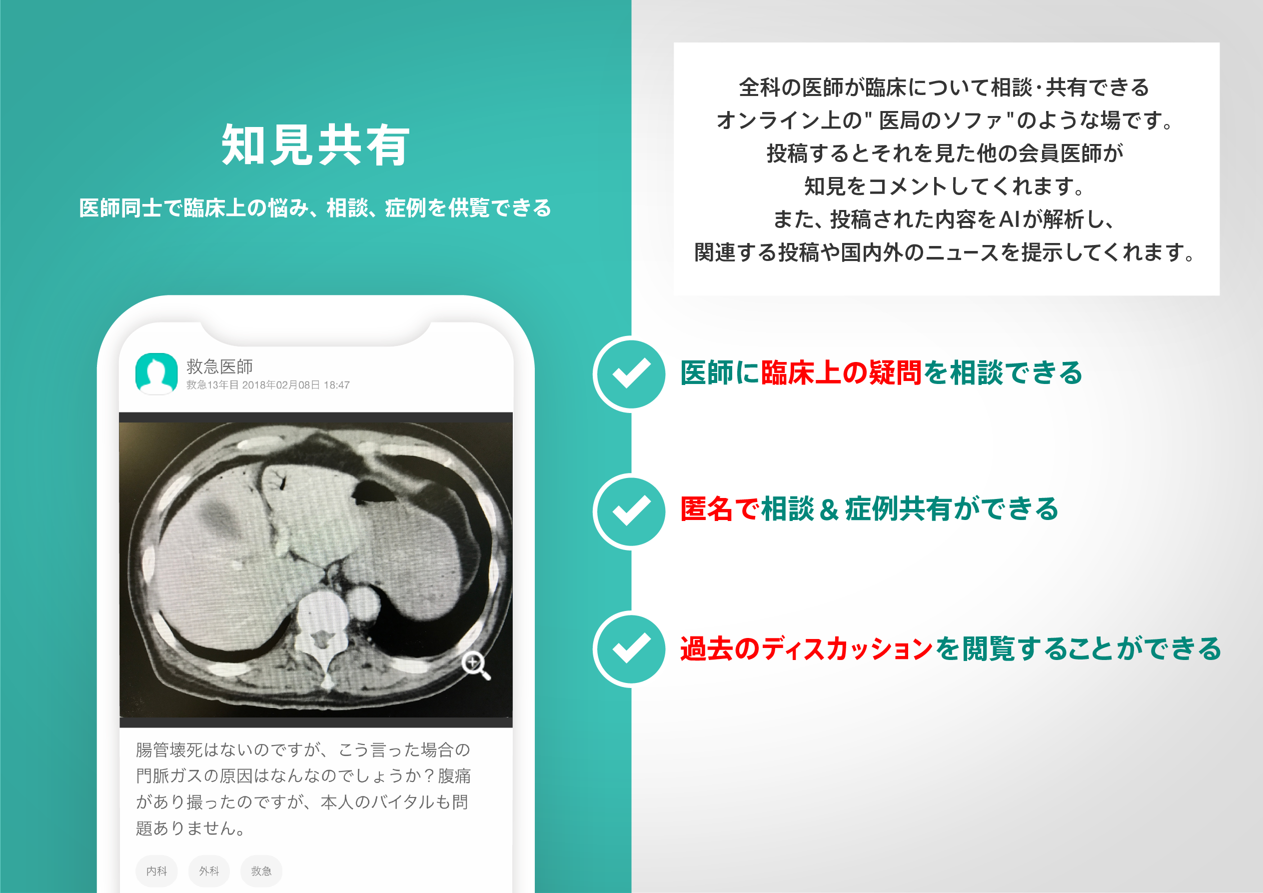
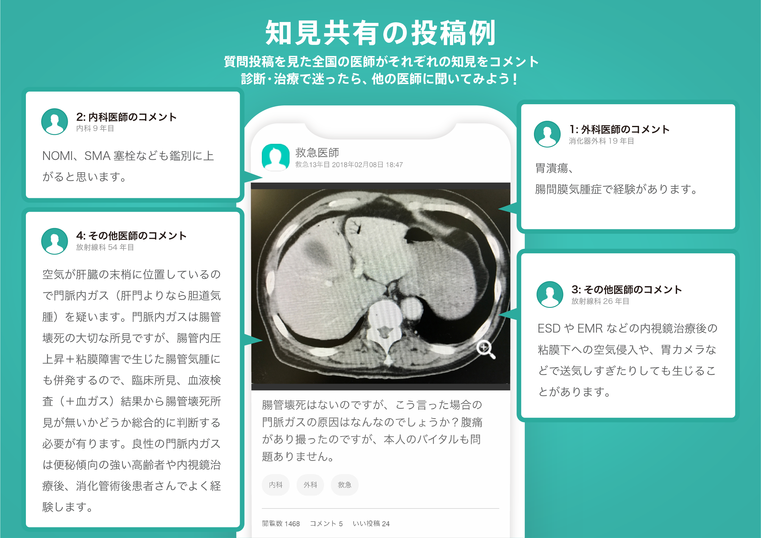
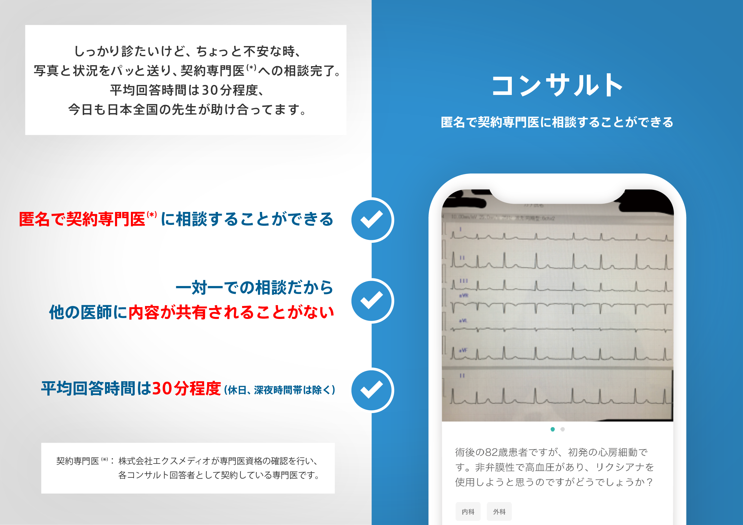
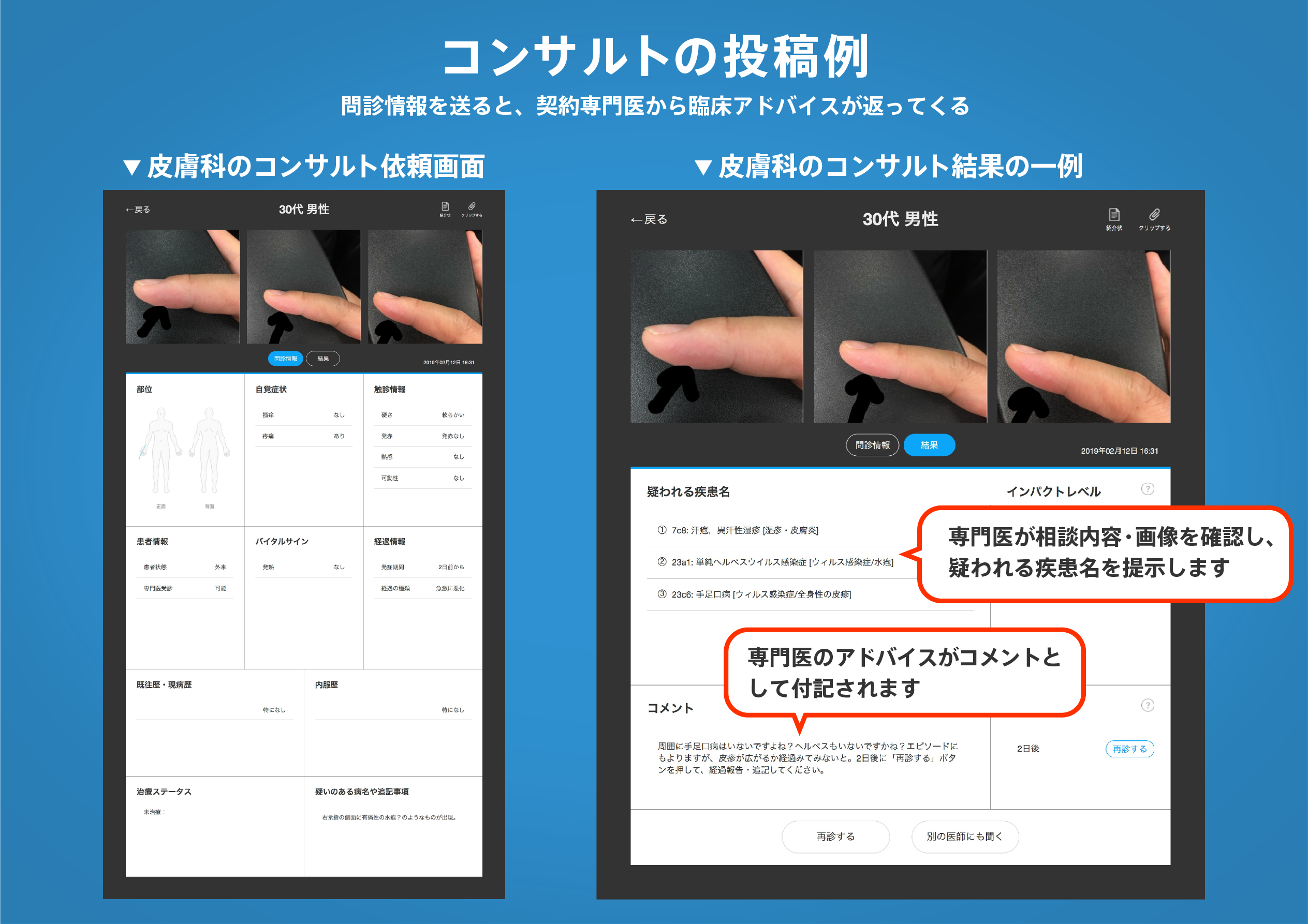
医師のための臨床サポートサービス
ヒポクラ x マイナビのご紹介


無料会員登録していただくと、さらに便利で効率的な検索が可能になります。