著名医師による解説が無料で読めます
すると翻訳の精度が向上します
山火事は世界中のWildland Urban Interface(WUI)コミュニティの人々や財産に対する大きな脅威ですが、北米、ヨーロッパ、オセアニアのWUIのパターンは以前に研究されていますが、これはラテンアメリカではそうではありません。私たちの目標は、a)アルゼンチン中部の地域地域であり、b)大規模な火災に特に重点を置いて、経験的モデルに基づいた推定火傷確率に重点を置いて、歴史的な火災に関連してWUIコミュニティの山火事曝露を評価することでした。276,700の建物の場所をデジタル化し、衛星画像から植生マップを導き出す後、中央アルゼンチンの山(810,000 ha)のウイをマッピングしました。家と野生の植生の混合物がインターミックスウイ(住宅密度> 6.17 hu/km2および野生の植生カバー> 50%)に分類され、野生植生が界面wui(住宅密度> 6.17 hu/km2、50%<50%batise betwed bethine)に分類された地域は、インターフェイスwuiに分類された地域です。1999年から2011年までの過去の火災データに基づいて、火傷確率マップを生成しました。火災頻度の経験的モデルから。WUI地域は調査地域の15%を占め、144,000の建物(52%)が含まれていました。ほとんどのWuiエリアはIntermix Wuiでしたが、ほとんどのWuiの建物は界面のWuiにありました。私たちの調査結果は、中央アルゼンチンにはWUI火災の問題があることを示唆しています。WUIエリアには、ほとんどの建物が山火事にさらされた建物と、より高い火傷の可能性のある地域にある建物のほとんどが含まれていました。私たちの調査結果は、より高いリスクのある分野で火災管理活動を集中させるのに役立ち、最終的にWUIコミュニティの山火事のリスクを減らすことを目的とした景観管理と計画をサポートします。
山火事は世界中のWildland Urban Interface(WUI)コミュニティの人々や財産に対する大きな脅威ですが、北米、ヨーロッパ、オセアニアのWUIのパターンは以前に研究されていますが、これはラテンアメリカではそうではありません。私たちの目標は、a)アルゼンチン中部の地域地域であり、b)大規模な火災に特に重点を置いて、経験的モデルに基づいた推定火傷確率に重点を置いて、歴史的な火災に関連してWUIコミュニティの山火事曝露を評価することでした。276,700の建物の場所をデジタル化し、衛星画像から植生マップを導き出す後、中央アルゼンチンの山(810,000 ha)のウイをマッピングしました。家と野生の植生の混合物がインターミックスウイ(住宅密度> 6.17 hu/km2および野生の植生カバー> 50%)に分類され、野生植生が界面wui(住宅密度> 6.17 hu/km2、50%<50%batise betwed bethine)に分類された地域は、インターフェイスwuiに分類された地域です。1999年から2011年までの過去の火災データに基づいて、火傷確率マップを生成しました。火災頻度の経験的モデルから。WUI地域は調査地域の15%を占め、144,000の建物(52%)が含まれていました。ほとんどのWuiエリアはIntermix Wuiでしたが、ほとんどのWuiの建物は界面のWuiにありました。私たちの調査結果は、中央アルゼンチンにはWUI火災の問題があることを示唆しています。WUIエリアには、ほとんどの建物が山火事にさらされた建物と、より高い火傷の可能性のある地域にある建物のほとんどが含まれていました。私たちの調査結果は、より高いリスクのある分野で火災管理活動を集中させるのに役立ち、最終的にWUIコミュニティの山火事のリスクを減らすことを目的とした景観管理と計画をサポートします。
Wildfires are a major threat to people and property in Wildland Urban Interface (WUI) communities worldwide, but while the patterns of the WUI in North America, Europe and Oceania have been studied before, this is not the case in Latin America. Our goals were to a) map WUI areas in central Argentina, and b) assess wildfire exposure for WUI communities in relation to historic fires, with special emphasis on large fires and estimated burn probability based on an empirical model. We mapped the WUI in the mountains of central Argentina (810,000 ha), after digitizing the location of 276,700 buildings and deriving vegetation maps from satellite imagery. The areas where houses and wildland vegetation intermingle were classified as Intermix WUI (housing density > 6.17 hu/km2 and wildland vegetation cover > 50%), and the areas where wildland vegetation abuts settlements were classified as Interface WUI (housing density > 6.17 hu/km2, wildland vegetation cover < 50%, but within 600 m of a vegetated patch larger than 5 km2). We generated burn probability maps based on historical fire data from 1999 to 2011; as well as from an empirical model of fire frequency. WUI areas occupied 15% of our study area and contained 144,000 buildings (52%). Most WUI area was Intermix WUI, but most WUI buildings were in the Interface WUI. Our findings suggest that central Argentina has a WUI fire problem. WUI areas included most of the buildings exposed to wildfires and most of the buildings located in areas of higher burn probability. Our findings can help focus fire management activities in areas of higher risk, and ultimately provide support for landscape management and planning aimed at reducing wildfire risk in WUI communities.
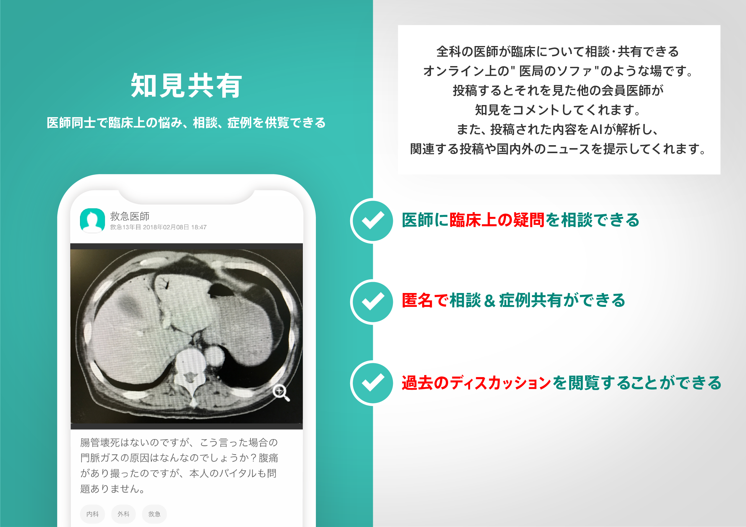
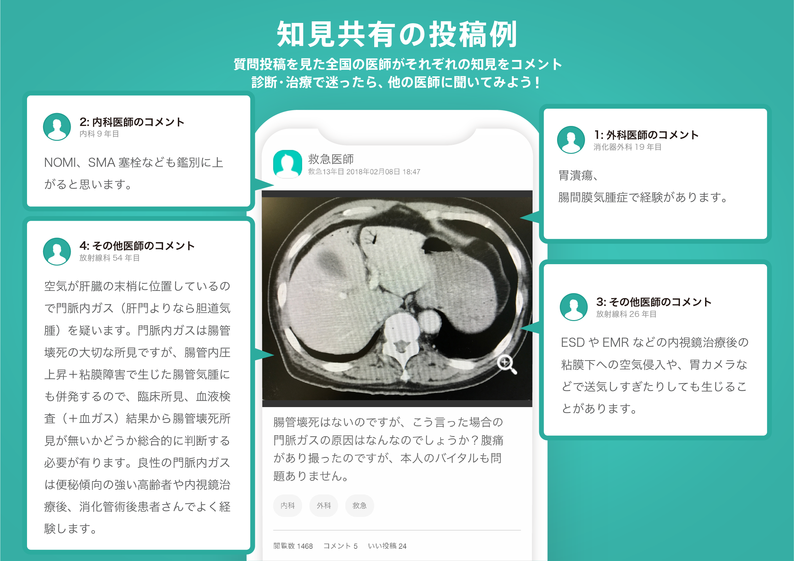
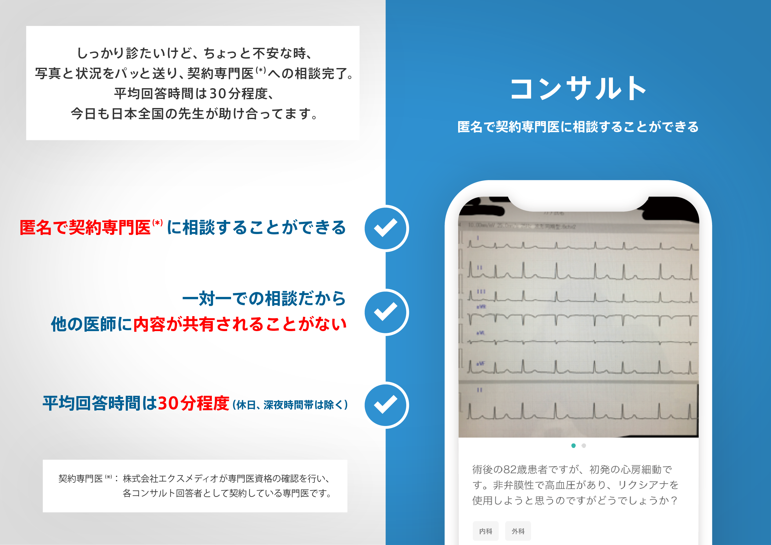
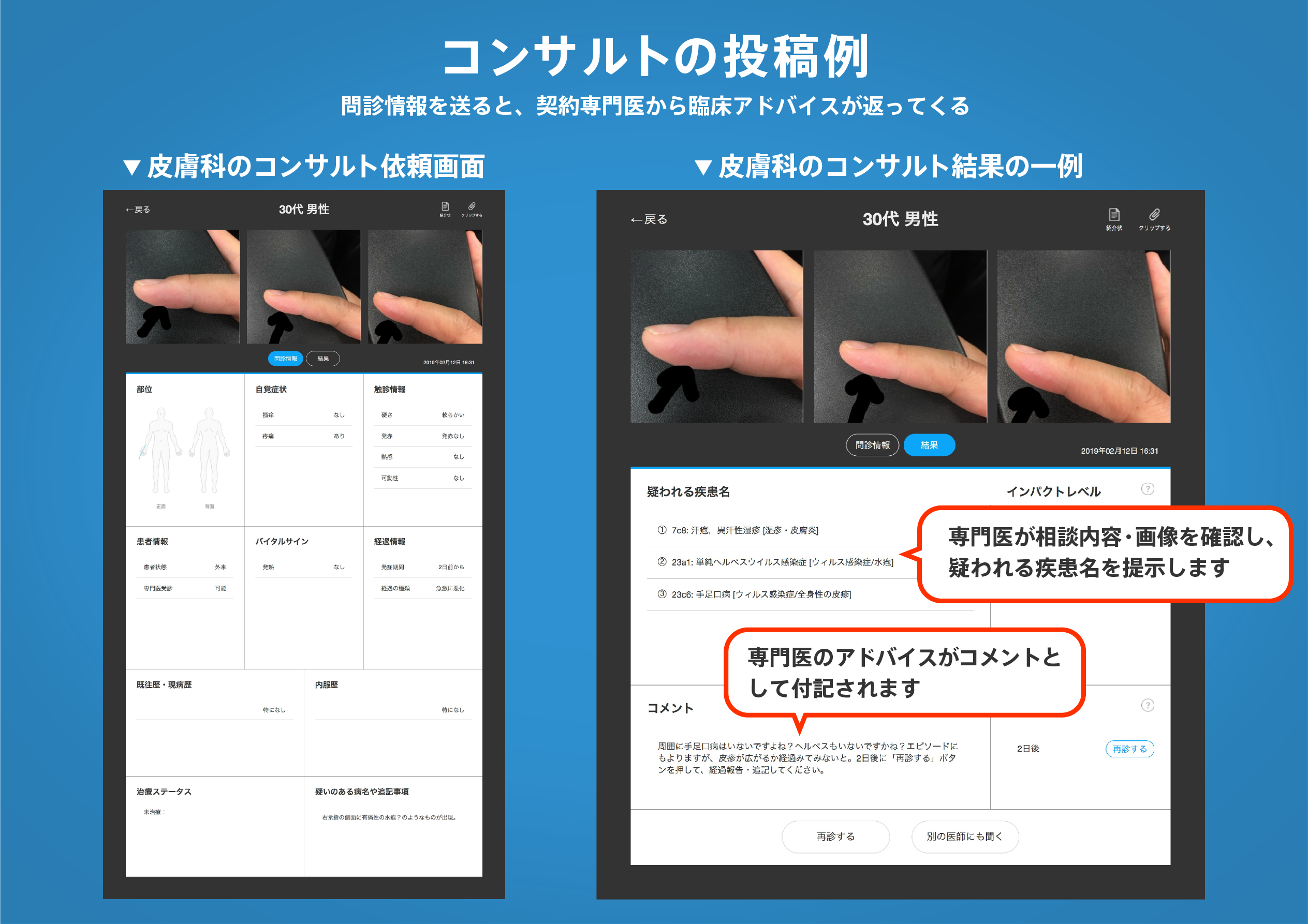
医師のための臨床サポートサービス
ヒポクラ x マイナビのご紹介


無料会員登録していただくと、さらに便利で効率的な検索が可能になります。