著名医師による解説が無料で読めます
すると翻訳の精度が向上します
衛星画像は、一般的に都市部の熱都市環境と熱島を定義するために使用されます。この研究の目的は、Landsat 5衛星のLandsat Thematic Mapper(TM)センサーが提供する衛星画像を使用して、ウズンデレ=エルズルムの熱環境を分析および評価することでした。土地利用と都市の表面の特徴に関して、熱都市環境の空間特性評価が定義されました。表面放射率、土地表面温度(LST)、および都市の表面特性との間のリンクをより効果的に定義するために、ウズンデレのCorine Land Cover(CLC)データベースも使用されました。Landsat衛星画像に基づいて、さまざまな土地被覆カテゴリが定義されており、これらのカテゴリに従ってヒート島の変化が特定されています。最小および最大表面温度は、オープンスペース、非菜食のむき出しの岩の多いエリア(それぞれ-1.8および29.1°C)から得られました。水領域の表面温度ははるかに優れており(7.5および21.9°C)、緑色の地域の表面温度(-0.9および28°C)が続きました。表面温度は、エネルギー中心の計画と見なされるべきです。
衛星画像は、一般的に都市部の熱都市環境と熱島を定義するために使用されます。この研究の目的は、Landsat 5衛星のLandsat Thematic Mapper(TM)センサーが提供する衛星画像を使用して、ウズンデレ=エルズルムの熱環境を分析および評価することでした。土地利用と都市の表面の特徴に関して、熱都市環境の空間特性評価が定義されました。表面放射率、土地表面温度(LST)、および都市の表面特性との間のリンクをより効果的に定義するために、ウズンデレのCorine Land Cover(CLC)データベースも使用されました。Landsat衛星画像に基づいて、さまざまな土地被覆カテゴリが定義されており、これらのカテゴリに従ってヒート島の変化が特定されています。最小および最大表面温度は、オープンスペース、非菜食のむき出しの岩の多いエリア(それぞれ-1.8および29.1°C)から得られました。水領域の表面温度ははるかに優れており(7.5および21.9°C)、緑色の地域の表面温度(-0.9および28°C)が続きました。表面温度は、エネルギー中心の計画と見なされるべきです。
Satellite images are commonly used for defining thermal urban environment and heat islands in urban areas. The objective of this study was to analyze and evaluate thermal environment of Uzundere-Erzurum using satellite images provided by the Landsat Thematic Mapper (TM) sensor on board Landsat 5 satellite. In respect to land use and urban surface features, spatial characterization of thermal urban environment was defined. In order to define the link between surface emissivity, land surface temperatures (LST), and urban surface characteristics more effectively, the CORINE Land Cover (CLC) database for Uzundere was also used. Based on the Landsat satellite images, different land cover categories are defined, and the alterations of heat islands are identified according to these categories. The minimum and maximum surface temperatures were obtained from open spaces, non-vegetated bare rocky areas (- 1.8 and 29.1 °C, respectively). The surface temperature in the water areas was much better (7.5 and 21.9 °C) and followed by green areas surface temperature (- 0.9 and 28 °C). Surface temperatures should be considered energy-focused planning.
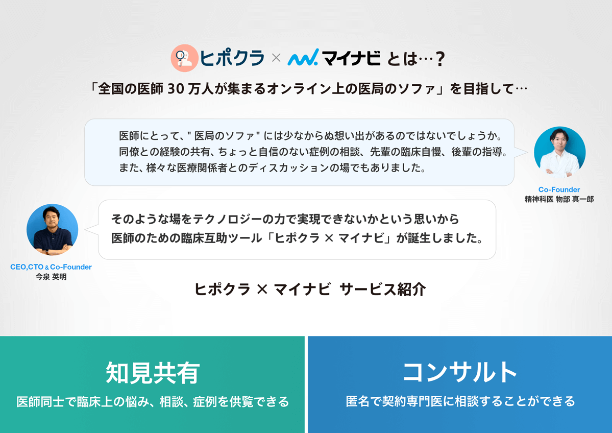
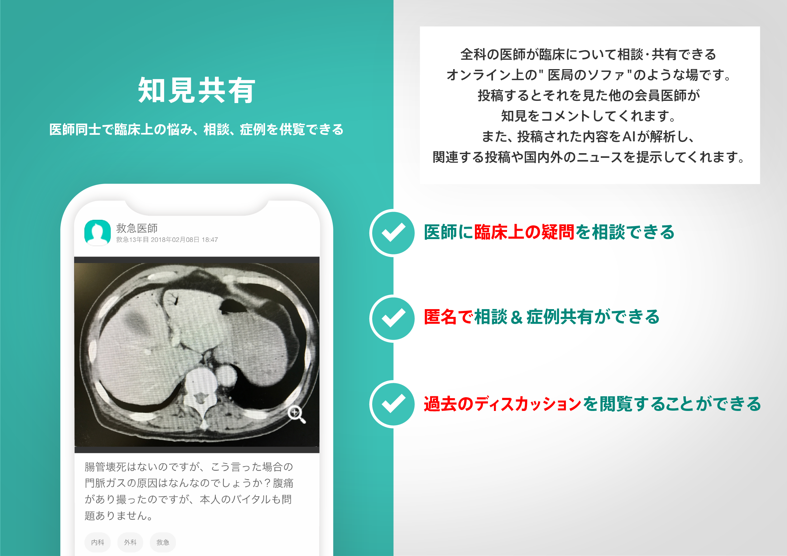
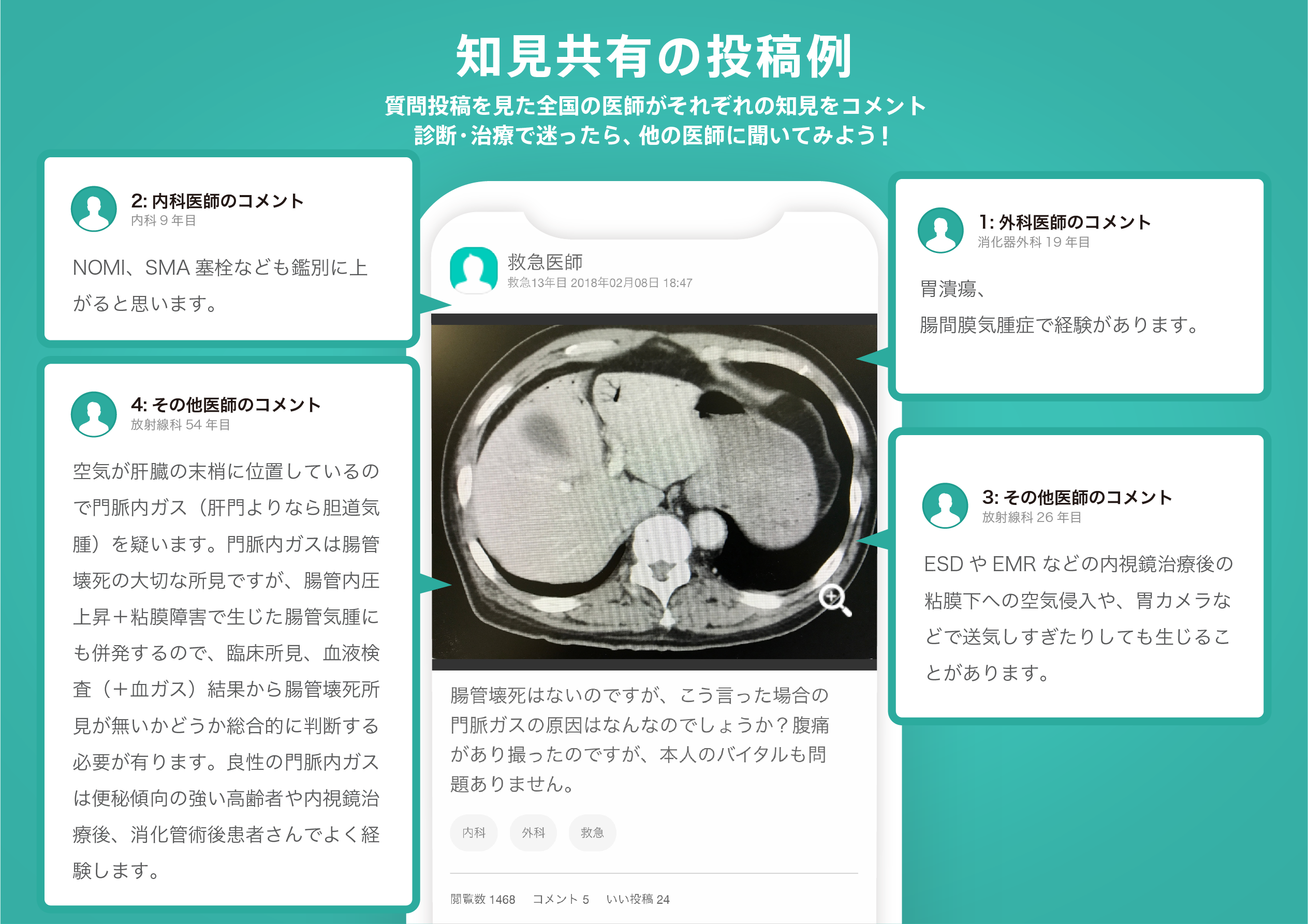
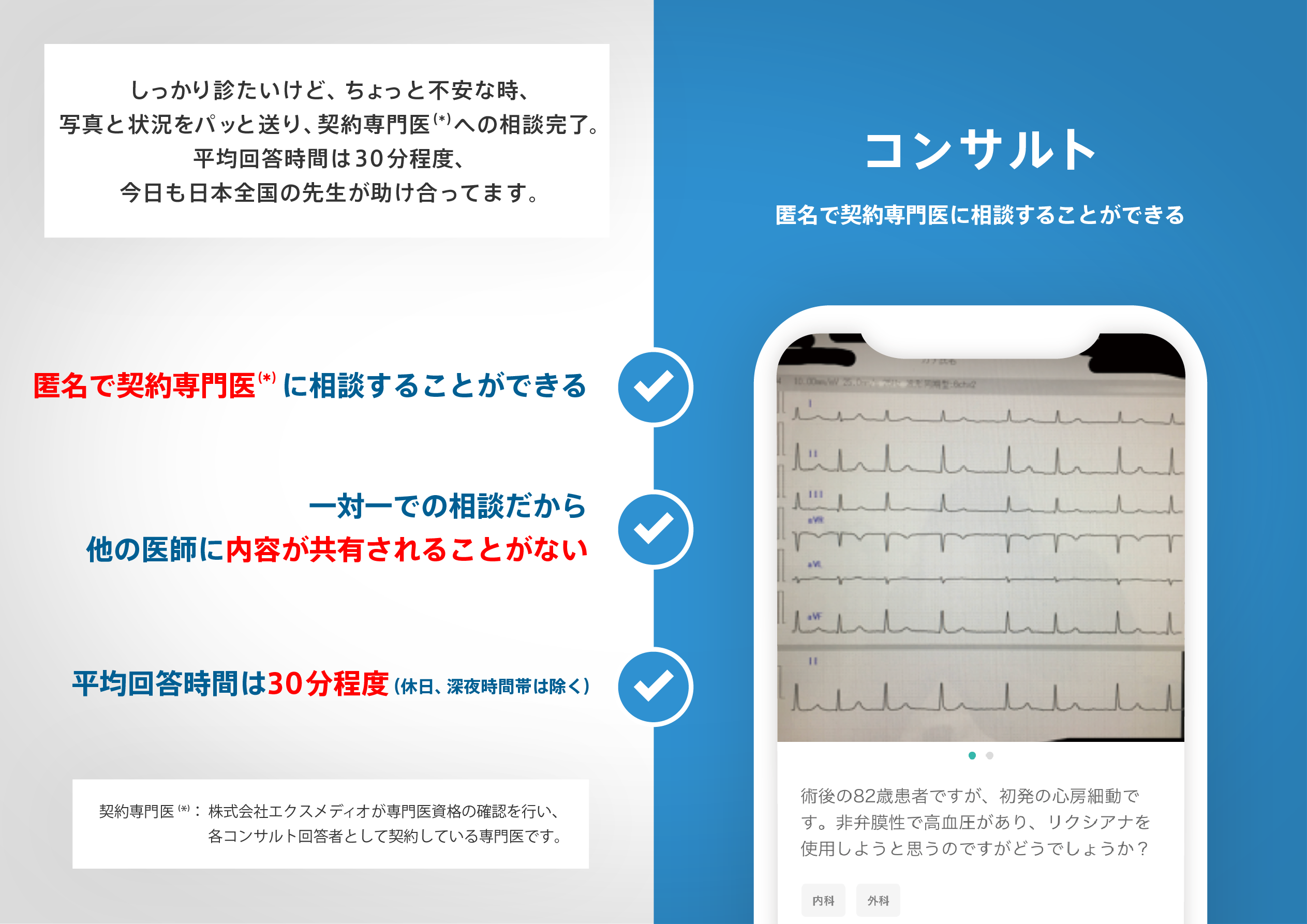
医師のための臨床サポートサービス
ヒポクラ x マイナビのご紹介

無料会員登録していただくと、さらに便利で効率的な検索が可能になります。